Understanding Topographic Maps: Reading and Interpreting

What Are Topographic Maps and Their Purpose?
Topographic maps are detailed representations of the Earth's surface, showcasing elevation and terrain features. They use contour lines to illustrate changes in elevation, allowing users to visualize the landscape in three dimensions. These maps are essential for outdoor activities like hiking, camping, and land-use planning, helping enthusiasts and professionals alike navigate complex terrains.
Topographic maps are a window into the world of the outdoors, revealing the hidden features of the landscape that can make a journey unforgettable.
In addition to elevation, topographic maps often display various features such as rivers, roads, and vegetation types. Each symbol on the map corresponds to a specific feature, making it easier to understand the environment. For example, a blue line typically represents water bodies, while dashed lines indicate trails or paths.
By providing a wealth of information in a compact format, topographic maps serve as invaluable tools for explorers and researchers. Understanding how to interpret these maps can enhance your outdoor experiences and help you make informed decisions about your adventures.
Understanding Contour Lines and Elevation
Contour lines are the backbone of topographic maps, representing areas of equal elevation. When you see a contour line, it signifies that every point along that line is at the same height above sea level. The spacing between these lines indicates the steepness of the terrain: closely spaced lines suggest steep slopes, while wider spacing suggests gentler inclines.
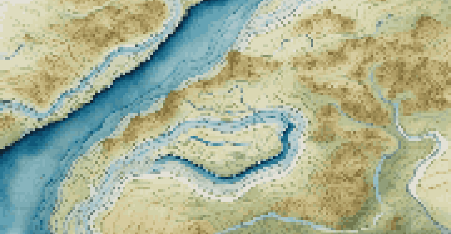
Each contour line is labeled with its corresponding elevation, often in meters or feet. For instance, if a contour line is labeled with '500,' it means every point on that line is 500 units above sea level. Understanding these numbers can help you gauge how challenging a hike may be or identify the best routes to take.
Understanding Topographic Maps
Topographic maps provide detailed representations of the Earth's surface, essential for activities like hiking and land-use planning.
Moreover, when contour lines form a V shape, it typically indicates a valley or a river. The point of the V usually points upstream, providing insight into the land's drainage patterns. Recognizing these patterns can significantly enhance your navigation skills and overall map interpretation.
Key Symbols and Features on Topographic Maps
Topographic maps are rich with symbols that represent various landscape features. These symbols are crucial for understanding what to expect in the terrain. Common features include trees, buildings, and roads, each represented by specific icons, which can usually be found in the map's legend.
A good map is a guide, a mentor, and a friend on the trails we traverse.
For example, a black square might indicate a building, while a green area denotes forested regions. Recognizing these symbols allows users to better plan their routes, ensuring a safer and more enjoyable journey. Additionally, some maps may include shaded relief, giving a three-dimensional feel to the terrain.
Becoming familiar with these symbols can transform your experience in the great outdoors. Instead of being overwhelmed by the map's detail, you'll find that each symbol tells a story about the landscape you are about to explore.
Reading Scale and Distance on Topographic Maps
Every topographic map comes with a scale that helps users understand distances accurately. This scale is often represented as a ratio, such as 1:24,000, meaning that one unit on the map equals 24,000 units in reality. Knowing this helps you gauge how far apart features are, whether you’re planning a day hike or a longer expedition.
In addition to the scale, many maps include a graphic scale bar. This visual tool allows you to measure distances directly on the map, making it easier to estimate how long a hike may take. By using both the scale and the graphic bar, you can enhance your navigation skills significantly.
Interpreting Contour Lines
Contour lines on topographic maps indicate elevation changes, helping users visualize terrain steepness and navigate effectively.
Understanding scale is essential, especially when traversing unfamiliar terrain. It helps you avoid getting lost or misjudging the distance to your destination, making your adventures safer and more enjoyable.
Interpreting Terrain Features: Hills, Valleys, and Ridges
Topographic maps are like a treasure trove of information about the terrain features you'll encounter. Hills are represented by concentric circles, while valleys often appear as U-shaped contours. Understanding these shapes allows you to visualize the landscape, making it easier to plan your route and anticipate changes in elevation.
Ridges, on the other hand, are typically shown with contour lines forming a V shape pointing away from high ground. Identifying these features can help you navigate through challenging terrains, especially in mountainous areas where elevation changes rapidly. The ability to interpret these features can significantly enhance your outdoor experience.
By familiarizing yourself with these terrain representations, you can better prepare for hikes, ensuring you choose paths that align with your fitness level and interests. It’s like having a map that not only shows you where to go but also tells you what to expect along the way.
Practical Tips for Using Topographic Maps
Using topographic maps effectively requires a bit of practice, but the rewards are worth it. Start by familiarizing yourself with the map’s legend and scale before heading out. This groundwork will give you a solid understanding of the symbols and distances, streamlining your navigation process once you’re on the trail.
Additionally, it’s helpful to compare the map with your surroundings. As you hike, take a moment to identify landmarks or terrain features that correspond to what you see on the map. This practice not only reinforces your map-reading skills but also deepens your connection with the landscape.
Practical Tips for Navigation
Familiarizing yourself with map symbols and comparing them to real-world features enhances navigation skills during outdoor adventures.
Finally, don’t be afraid to take notes while using your map. Documenting your observations and experiences can enhance your future adventures and help you refine your navigation skills over time. Remember, practice makes perfect!
The Importance of Topographic Maps in Outdoor Activities
Topographic maps are invaluable for a wide range of outdoor activities, from hiking and camping to mountain biking and orienteering. They provide critical information about the terrain, helping enthusiasts choose the best routes based on their skill levels and interests. Whether you’re an experienced adventurer or a beginner, understanding these maps can enhance your outdoor experiences.
Moreover, topographic maps can help you plan for safety. By identifying potential hazards, such as steep cliffs or difficult river crossings, you can prepare accordingly. This foresight allows you to pack the right gear and inform others about your route, ensuring a safer journey.

In a world where technology often takes center stage, topographic maps remind us of the importance of traditional navigation skills. They encourage us to engage more deeply with our environment and appreciate the beauty of the landscapes we explore.